Meandering about Lakefront Boundaries
If you own waterfront property, where is your property boundary, and who is your adjacent parcel owner on the waterfront?
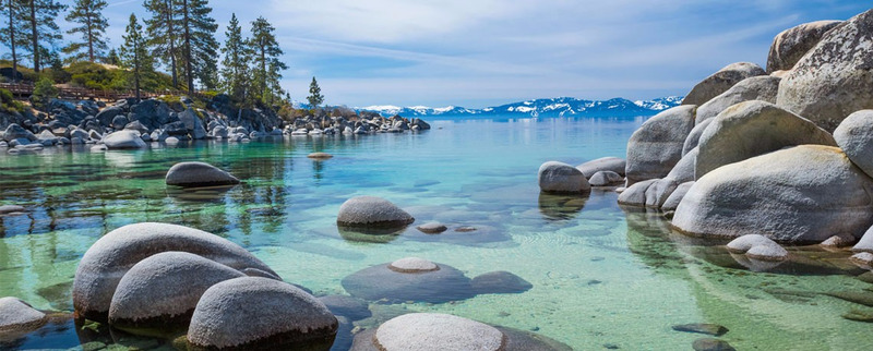
At Lake Tahoe and many other inland (“non-tidal”) bodies of water, the boundary between the waterfront property (a/k/a the “upland” parcel) and the body of water is defined by a \ line that roughly parallels the water’s edge. This line is called “meander line.” In 1861 and 1875, prior to the sale of government lands around Lake Tahoe, government surveyors created a meander line along the edge of Lake Tahoe. The meander line is generally some distance landward from the water’s edge (not the actual high water mark) and was used to determine the acreage and price of the lands to be sold by the federal government to the original land patent holders.
State and federal law provide that when title to waterfront property is described by a meander line of a government survey, or by a subsequent subdivision of the same land bounded by the meander line, the title of the upland owner extends to the body of water itself. So, just how far does the parcel extend toward the body of water?
If an inland body of water is navigable – like Lake Tahoe – the State owns the lakebed as it existed at the time of statehood (which typically means before there were dams, or artificial raising and lowering of the lake level). In Nevada, a 1979 statute established the boundary line of the lakebed at 6,223 feet, Lake Tahoe datum, which approximates the lake’s ordinary low water level. Accordingly, a deed conveying lakefront land on the Nevada side of Lake Tahoe that uses the old government survey meander line as the boundary conveys title all the way to the lakebed at 6,223 feet. This means your neighbor along the water’s edge is the State of Nevada.
Similar rules apply in California. Generally, the owner of the upland, when it borders on tidal waters, takes to ordinary high-water mark; when it borders upon a navigable lake or stream, where there is no tide, the owner takes to the edge of the lake or stream, at low-water mark; when it borders upon any other water, the owner takes to the middle of the lake or stream. In Tahoe where there is no tide, the rights of the owner to low-water mark are included in the conveyance.
In California, even though a private landowner’s title extends to the ordinary low water mark, there is an easement or public trust under which the general public may recreate in the land area that lies between the ordinary low and high-water marks. Nevada recognizes the public trust doctrine in certain instances, but does not recognize a right of the public to sunbathe or recreate in the area between low and high water. Waterfront land is usually the most valuable property in any particular market. As you can see, there are some unique rules that apply to valuable land with waterfront boundaries. If you have questions about your waterfront boundaries, please call Incline Law Group, LLP.
